
Get the latest construction industry insights and platform updates delivered to your inbox.
© 2026 Consnect. All rights reserved.
The National Land Authority (NLA) has launched a strategic surge to resolve over 55,000 pending land surveying applications within the next 60 days. By deploying a specialized task force of 100 private surveyors and leveraging modern GNSS technology, the move aims to fast-track land subdivision, titling, and registration—essential catalysts for construction investment and large-scale development.
Redempta
28 days ago
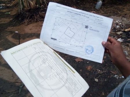
For developers, investors, and construction firms, the "wait time" for land demarcation is about to evaporate. The National Land Authority (NLA) has announced a decisive intervention to clear a backlog of 55,000 pending applications by the end of February 2026.
This move is not merely an administrative cleanup; it is a vital economic unlock. By resolving these files, the NLA is removing the primary obstacle to land transfers, subdivisions, and registrations—the very documents required to secure project financing and building permits.
To tackle the limited personnel at the district level, the NLA has partnered with the Private Sector Federation (PSF) to deploy 100 certified private surveyors. This public-private partnership (PPP) model is designed to:
Accelerate Timelines: Processing two years' worth of backlog in just two months.
Enhance Transparency: Applicants can now track their status in real-time via the amakuru.lands.rw portal.
Ensure Lawful Transactions: Providing the legal certainty required for inheritance, consolidation, and high-value land transfers.
The current backlog is a symptom of a positive regulatory shift. Since the 2021 land law abolished the minimum one-hectare requirement for agricultural land subdivision, applications have skyrocketed. This policy change allows for smaller, more flexible land parcels, enabling more citizens and developers to hold formal titles—though the NLA maintains strict guidelines to ensure agricultural land is not illegally converted for unauthorized residential sprawl.
For stakeholders in high-end infrastructure and commercial real estate, accuracy is non-negotiable. The NLA is moving beyond historical inconsistencies with the launch of the Cadastral Surveying Procedure Manual.
Key Technical Advancements Include:
Advanced Hardware: Integration of GNSS (Global Navigation Satellite Systems), total stations, and laser scanners.
National GeoNet System: Utilization of 10 Continuously Operating Reference Stations (CORS) providing real-time high-precision data.
Standardized Workflows: A unified step-by-step approach from fieldwork to digital submission via the Irembo platform.
"The most successful projects of the next decade won't be defined by their height, but by the integrity of their data. We are ensuring that every boundary is accurate, consistent, and legally indisputable." — Implications of the new NLA Standards.
The government’s goal to resolve all boundary demarcation issues by 2027 is ahead of schedule. For construction stakeholders, this means:
Reduced Risk: Precise boundaries eliminate costly neighbor disputes and litigation.
Faster Financing: Clear titles mean quicker approvals for bank loans and investment tranches.
Market Fluidity: Easier subdivision and consolidation allow for more dynamic real estate portfolio management.
As the NLA deploys its 100-man "backlog team" this month, the construction industry can look forward to a more streamlined, digital-first environment that respects the value of time and the precision of modern engineering.
Sign in to share your thoughts and engage with the community